
I have this habit of planning trips last minute, usually less than a week before. So, I end up in a national park with no idea what I’m going to do, and I just figure it out. On this particular trip, I decided to head to Sequoia and King’s Canyon National Parks for the weekend.
Compared to Yosemite, these parks are visited by much fewer people and so it is easier to get a campground last minute. I was able to get two nights on the King’s Canyon side. This year much of both parks are closed due to the heavy winter causing mudslides over parts of the road. As a result, it’s not actually possible to get to “King’s Canyon” in King’s Canyon National Park.
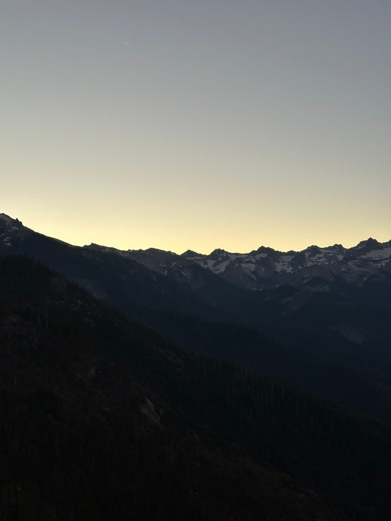
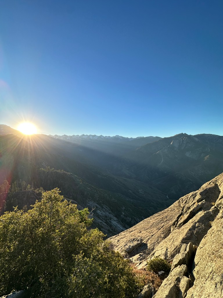
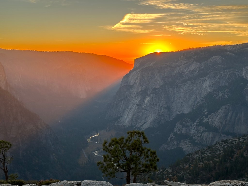
I should also mention that phone service is essentially non-existent in these parks. I had been once before in he winter and attempted to climb Morrow Rock, suffice to say it became a little sketch with the iced over steps and I wasn’t about to risk my life. But in summertime, it’s an easy ascent all the way to the top! So this time I decided to get up at 4am to make the drive across the General’s Highway to watch the sunrise from atop Morrow Rock. The sunrise was gorgeous, photos below.
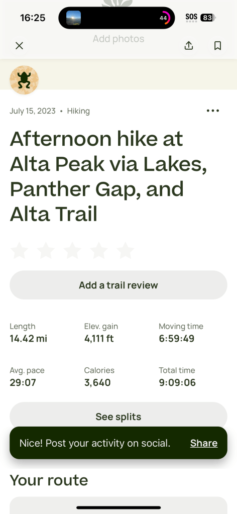
While I was on top of Morrow Rock, I was able to find a place with phone service and decided to look up hikes to do in Sequoia National Park (still had no idea what I was going to do at this point). I pulled out my trusty AllTrails and started looking up hikes. I found this hike I had never heard of called “Alta Peak” and it had great reviews with awesome views. However, all the recent reviews (as of mid July 2023) said that there was still a lot of snow on the hike with portions of the trail completely obscured by snow.
I’m not one to back down from a challenge, so I plugged it into my AllTrails so as not to get lost and descended from Morrow Rock and drove to the trailhead. This is an about a 14 mile hike roundtrip, which isn’t too hard. I figured since the last review was a couple of weeks ago that the snow would be melted. Boy was I wrong, but we’ll get to that later. I began this hike with just my basic hiking gear (definitely missing at least half of the 10 essentials) and no ice spikes.
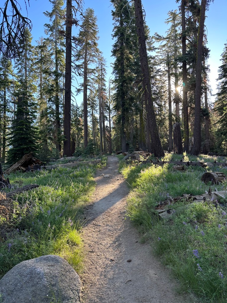
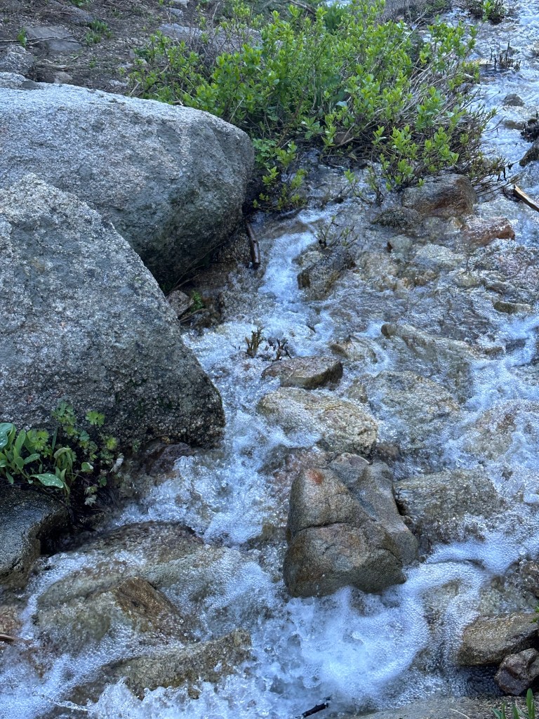
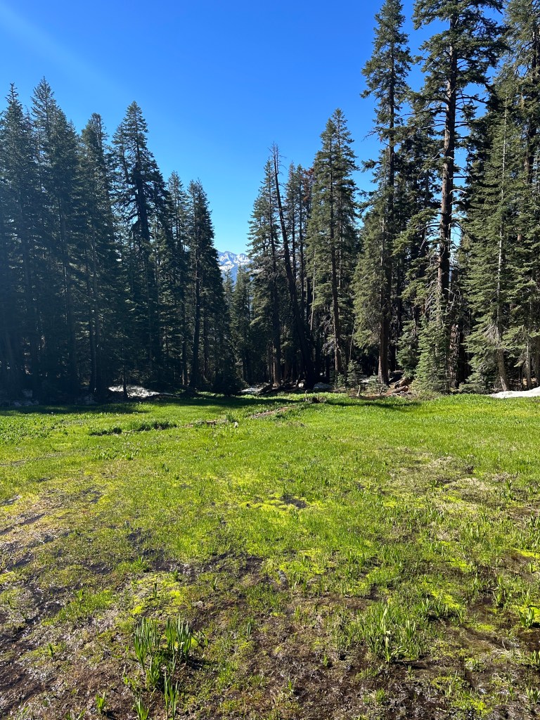
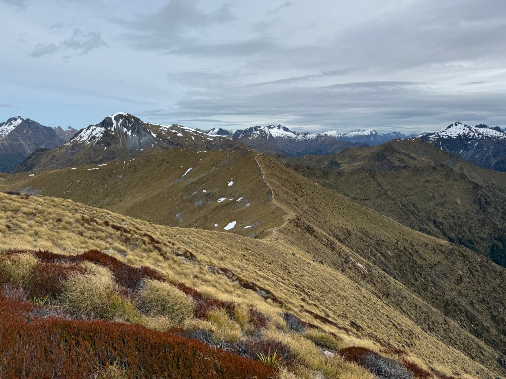
The first couple of miles were through forest and meadows with plenty of wildflowers. I also came across many streams cutting through the trail. Evidence of the heavy winter was plentiful with downed trees over the trail frequently. I also started to see snow off the sides of the trail, and had to traverse over a couple banks of snow on the trail. This was a little worrisome considering I was only a couple of miles in and had the majority of elevation gain to go. I didn’t see anyone my entire way up other than a backpacker camp off the side of the trail. But once I hit the backpacker camp I caught my first glimpse of some amazing views.
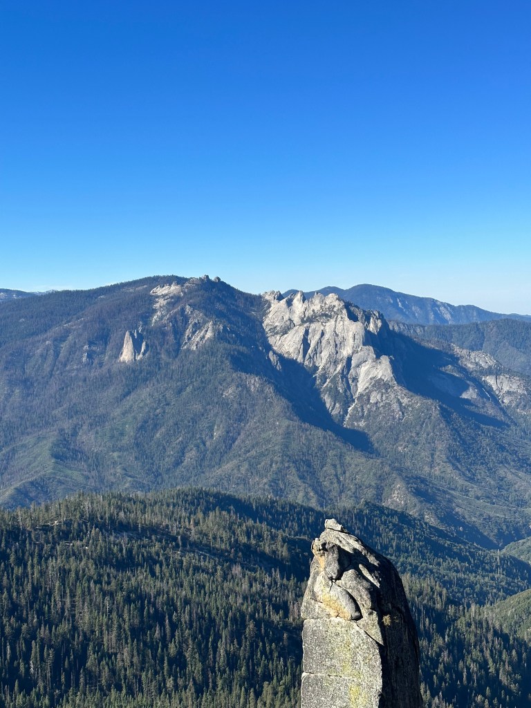
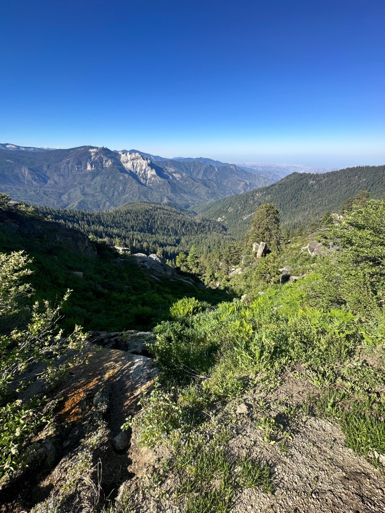
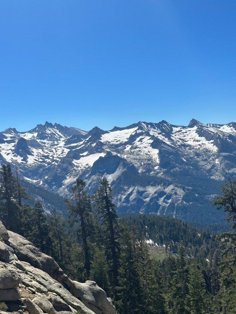
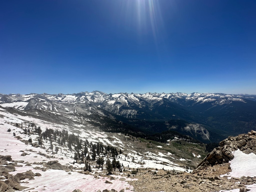
I took a minute to enjoy the views and take some photos, then I continued on the trail. The next couple of miles were gorgeous with panoramic views of the mountains in the distance. Now the hike was exciting, sunshine, greenery, and rivers were everywhere.
Now I started to hit the incline and snow on the trail became more and more frequent. Thank goodness for AllTrails, because I would have gotten lost at several different points if I didn’t have the hike tracker turned on. I did pass a large meadow with a running stream that was so peaceful. I even had to cross the remains of a large avalanche from last winter.
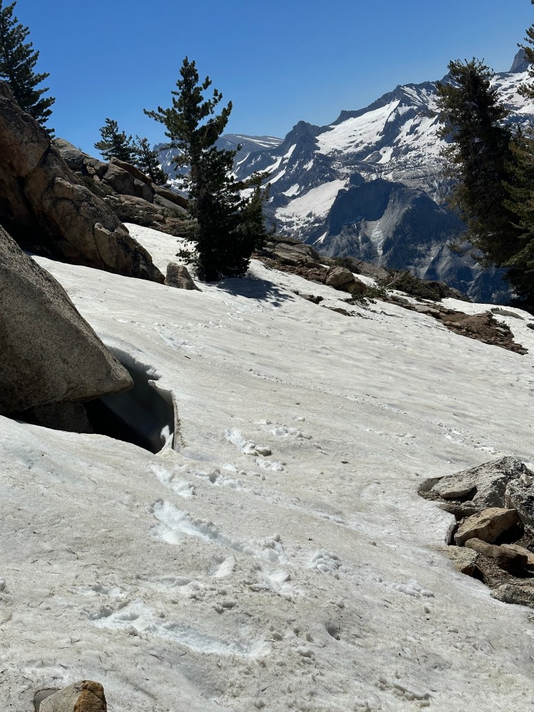
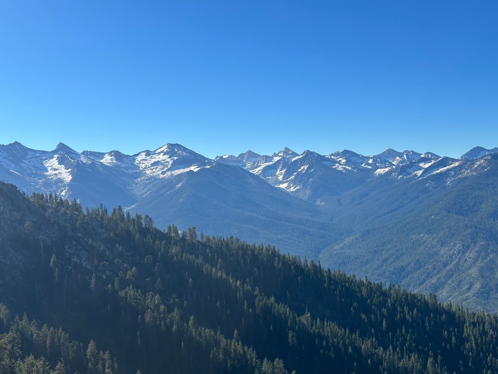
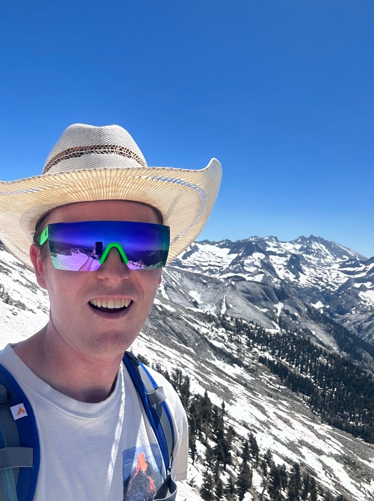
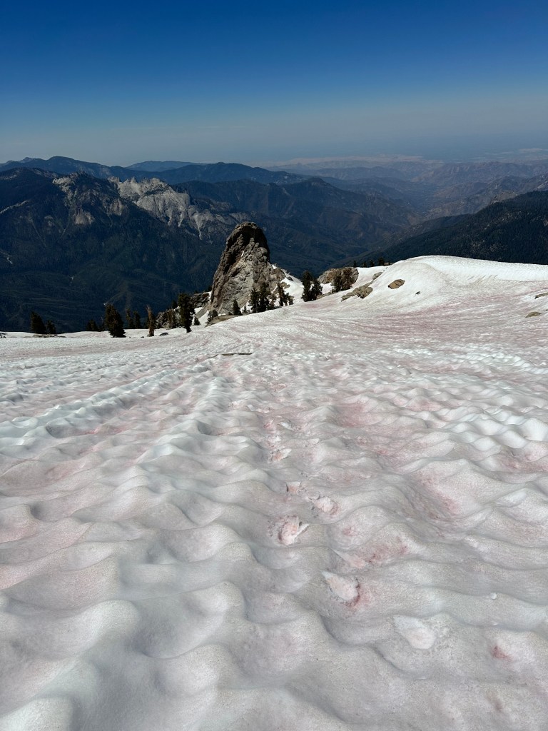
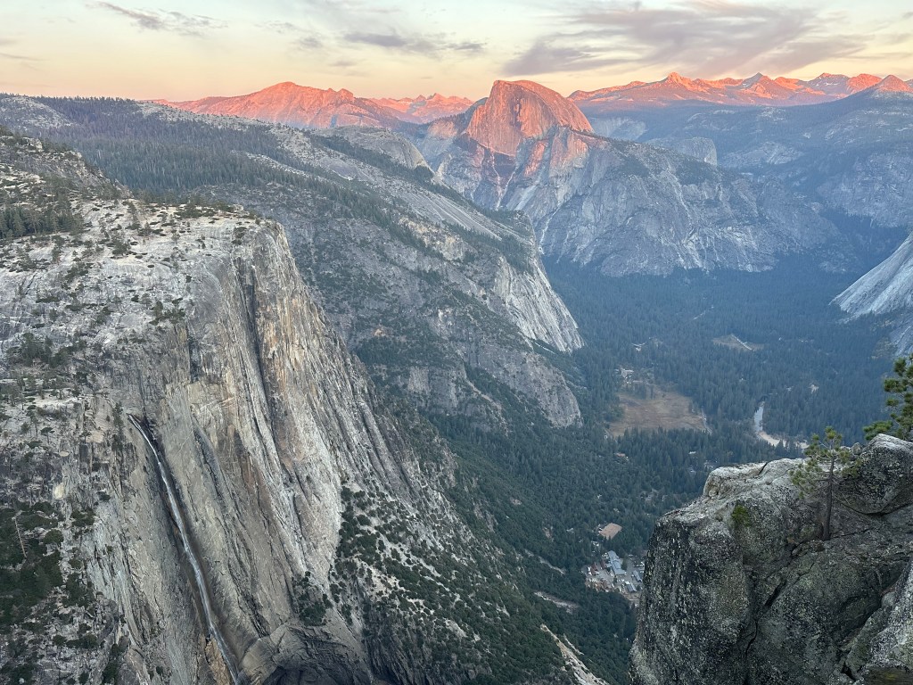
I got to the point where the trail completely disappeared and I was exclusively following AllTrails map. The last mile and a half was completely up a glacier, and all I had was regular trail running shoes. It was tough climbing up that last little bit, but I’m no quitter and I was going to finish what I started. I slipped a few times and my feet were cold and soaked by the time I reached the peak. The only way to describe the views at the top is magical. Panoramic views in all directions. I sat up there all by myself for about an hour, enjoying the view and eating my lunch. I sat there in total silence and awe. Some of the most incredible views I’ve ever seen. This was one of the first hikes where I honestly didn’t want to leave the top, because the views were so incredible. Pictures aren’t even half as good as the real thing.
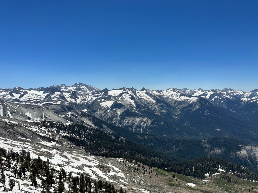
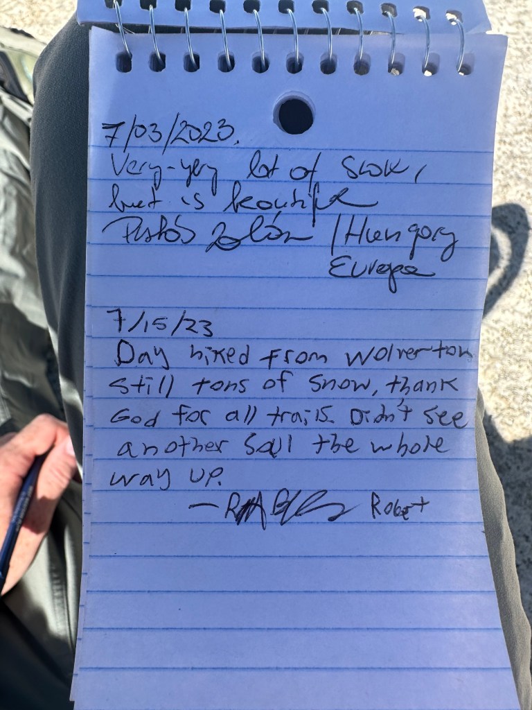
There was also a metal lockbox at the top with a notebook and pencil where everyone could leave their message, the last person to summit was two weeks before me when the snowpack was even worse. This hike was exhausting and much more than I bargained for, the difficulty just made me appreciate the views that much more. It’s about 4,000 ft of elevation gain in just under 7 miles, so under normal circumstances it’s no joke but with all the snow that just took it to another level.
Again, I had made it all the way to the top without seeing another soul other than the backpacker camp. Now on my descent down, I passed a few people trying to make it up. Some hikers had definitely gotten lost and I pointed them in the right direction back to the trail. By the time I got down I was so tired and all I wanted was food and sleep. So I went to the Wuksachi Lodge and had a bowl of spaghetti and pizza before continuing back to the campsite.
I also finished my evening at Buck Rock for sunset, but that’s another post for another time!
This hike was an 11/10, I highly recommend it for anyone looking to get away from the crowds and enjoy being in nature with some amazing views that will take your breath away if the elevation gain hasn’t already! This is not for the faint of heart though and you do need to have some level of fitness to complete this hike. I also would not recommend it without a Mini Garmin GPS type tracker, the trail map, and some ice spikes for your shoes. The snow is probably not going to melt this year and will still be there next summer as well.
I will do this hike again, maybe I’ll see you on the trail! Happy hiking.

Leave a comment